


The north side of the province, the area above "Mohlos" until the city of Sitia is characterized by an agricultural landscape, spreading over the sides of the hills and the mountains, where hidden rubble walls stand and the olive tree prevails. Here visitors can enjoy the distant view of the sea and the southing breeze of the imposing mountains, the picturesque villages and the local communities with their traditions and warm hospitality.
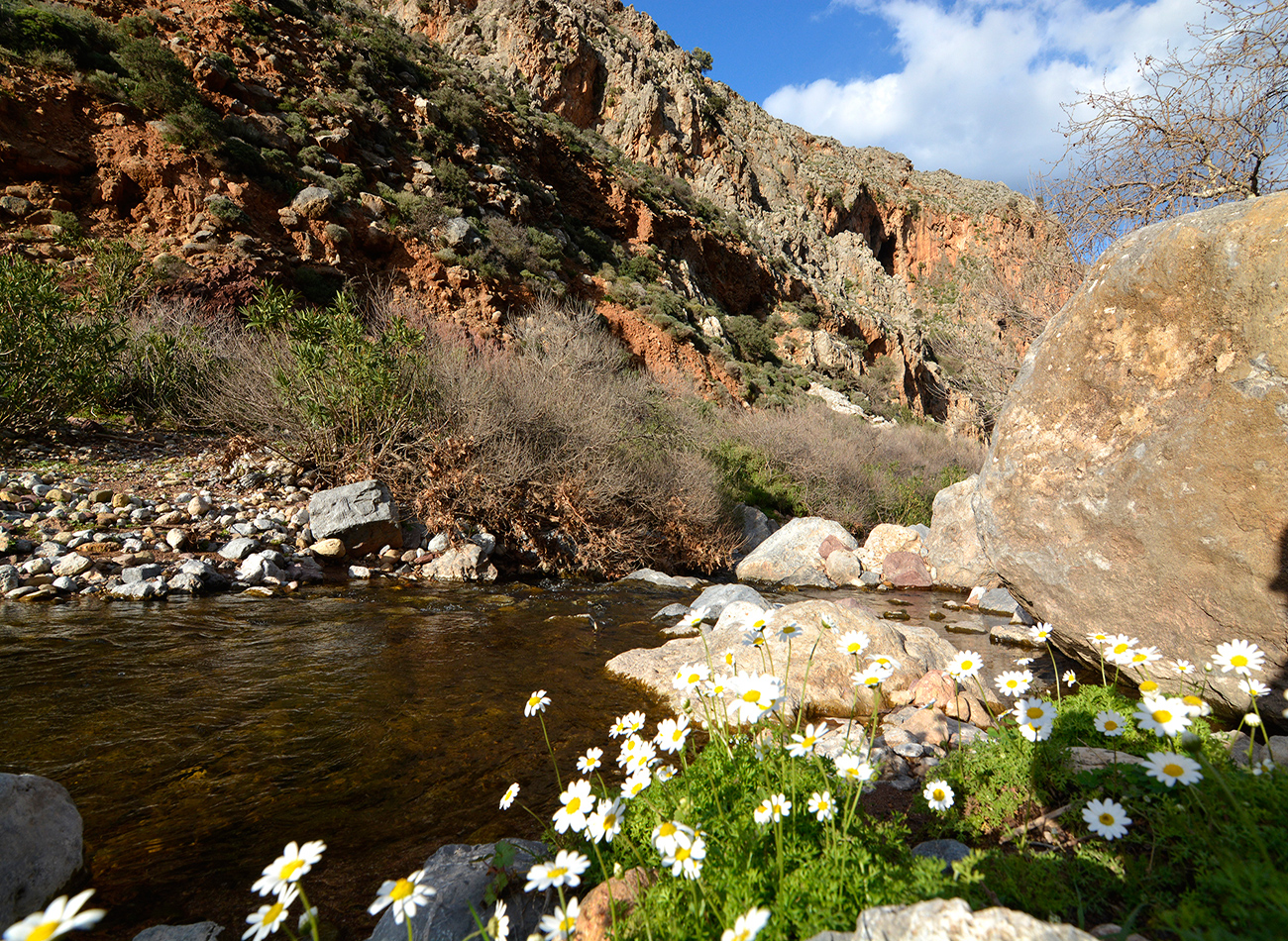
South Sitia, the area over "Achlias", "Koutsouras" and "Makry Gialo" until "Goudoura" is characterized by the magnificence of the high mountains with the deep and wild gorges, the green valleys, the picturesque traditional villages and the view of the endless sea and the coexistence of the olive trees and the greenhouses on the valleys, the warm climate and the long sandy beaches.
The city of Sitia and its wider region is characterized by a plain landscape with green and fertile valleys and beautiful villages, a little heaven with rich history and cultural heritage, numerous archeological sites and Venetian monuments. It is a region that combines the traditional and the modern character of the beautiful and peaceful city of Sitia, the capital of the province.
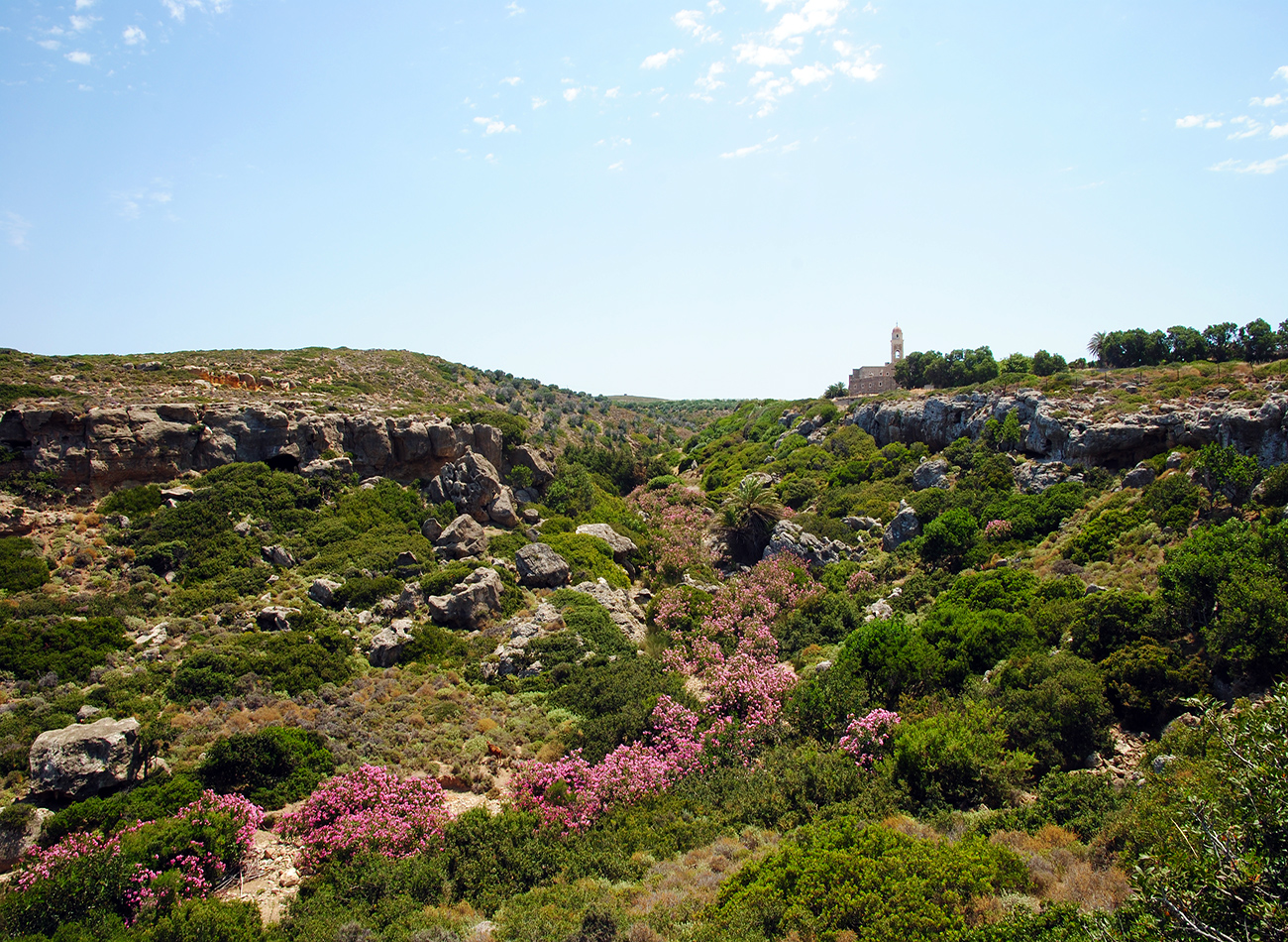
East Sitia, the regions of Palekastro - Zakros- Xerokambos are characterized by a peaceful landscape, mountainous and plain embraced by the deep blue sea and the dazzling sun, the open horizons and the magnificent colors of the sky and sea that inspire painters. Visitors will be seduced by the beautiful sandy beaches, the African touch on the landscape, the vibes of an ancient world and its mysteries coming from the Minoan palace and the other ancient cities of the area and from the mystical feeling and magnificence of the historical Toplou monastery.
At the center of the province stand the imposing plateau of Handras and the "rockygarden" of Karydi. An uplifting and liberating feeling and a primeval sense of eternal greatness take over as one enters these magical places.
Above there is only the sky!
The beautiful plateau of "Handras" with its fertile plain ground, the vineyards, and the gardens with the old watermills and wells, assign a sense of wealth and abundance. The old frescos in the churches and the monastery of "Aghia Sofia", the great monuments, the traditional settlement of Etia with the Venetian villa DEI MEZZO and the medieval settlement of Voila with the church of "Ai Giorgi", the tower of "Zenon", the fountains and the deserted manors, all stand witnesses of the great historical flourishment of the region and invite visitors to a travel in time. Today the plateau of "Handras" struggles for survival and growth, and recent developments indicate a better future.
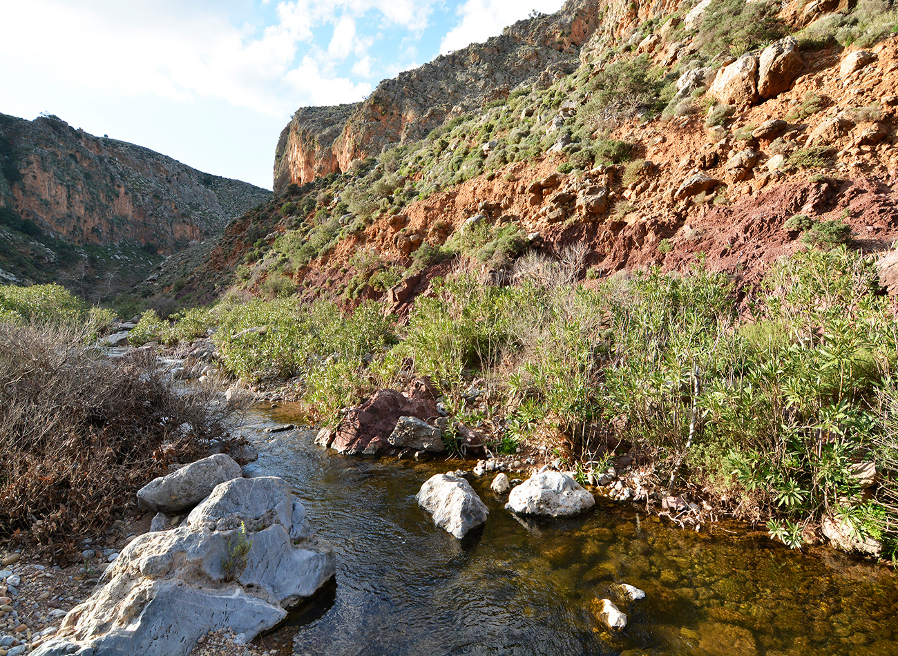
A completely different picture is projected on the plateau of "Karydi", located on the mountainous area on the southeast of Sitia and west of Zakros. Here is the "Kingdom of Stone", the "rocky-garden" of Nikos Kazantzakis, the imprints of the world's creation. Here visitors experience in the most direct way the mystic genesis of the earth and the traces of the complex geological procedures that shaped the island of Crete. Here is where God spoke with the stones!
Here is the place where the architecture of the rock and the sculpture of nature meet their perfection, creating masterpieces of divine inspiration. This is also the place where one can admire the power of humanity. Through stone, the human managed to survive and create civilization! The stone-made houses, the stockyards, the shepherd's huts, the dams, the vineyards, and the gardens surrounded by stonewalls, suddenly become works of admiration and symbols of human ability and will to survive, create and develop.
Here is where the popular "mantinada" (Cretan poems/rimes) of Kostis Fragkoulis-Antaios finds its vivid expression: "Lots of stone, little water, the ground dispersed, this is Sitia, the beautiful, with the nice people!"
Another region is also notable for its unique charm. It is the route from "Piskokefalo" and "Ahladia" to "Chrusopigi" and "Bebonas". The interchange and the variety of the landscape is extraordinary. Green valleys and water streams in the beginning, hills covered with olive trees and vineyards, mountains where bushes and aromatic plants grow, picturesque villages and cultivated fields, mountains from the left and right that resemble more the "far west" rather than an island, farmer houses covered in green, and at the end, the high and imposing mountains and gorges, such as the mountain "Kliros" and "Mesonas". Here is a place where visitors can experience farmer life and old traditional Crete.
Dàfni – Péfki
We set off at the Dàfni village square in a southerly direction. We pass next to the cemetery and take a dirt road that goes left (eastwards), parallel to a steep slope. Approximately 900 m after the village, at the end of the steep slope, we leave the dirt road and take a vague path, in a rather south-easterly direction. After approximately 700 m, we come upon another unsurfaced road, which we follow southwards. We ignore a left-hand turn-off and continue southwards for about 1.000 m; we then leave the dirt road and follow a path which is not clear, in a due southerly direction. We walk for 700 m, to a flat area where the beginning of a small gorge can be seen.
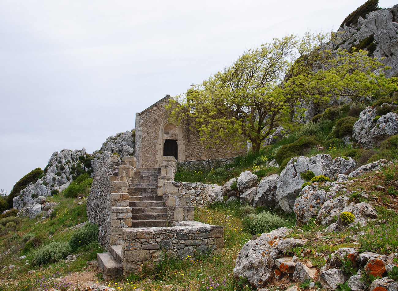
We walk along the bed of the gorge for approximately 1.000 m; we then leave it and take the rough footpath, walking on its western side, where a characteristic fig tree can be seen, at the entrance of the Vréiko cave. From the cave and on we walk on a clear path. After approximately 250 m we reach a parking area and an asphalt road, which we follow for about 150 m; we then turn right into a dirt road that leads us to the northern side of a characteristic rocky summit (8), on top of which there is a picturesque chapel. From the northern side of this rock we follow the easily distinguishable footpath that meanders on its eastern side; after approximately 1.000, we arrive at the village of Péfki.
Péfki – Makrygialós
We walk along the narrow, picturesque alleys of the village of Péfki and follow the asphalt road south-west of the village for approximately 250 m. We then turn left into a rough dirt road which passes through an olive grove and then leads us to a footpath which passes next to an old watermill. The unsurfaced road runs along the edge of the western wall of the gorge of Péfki for approximately 500 m; next it turns right and descends to the bed of the gorge, which features exceptionally beautiful formations and dense vegetation.
For approximately 1.000 m we follow the rough bed of the gorge and then come upon a dirt road, which we take in a southerly direction for about 1.300 m, to the settlement of Áspros Potamós. After Áspros Potamós we cross the water course; the dirt road continues to run parallel to its eastern bank for approximately another 1.500 m, until it reaches the coastal settlement of Makrygialós .
Skalià - Zàkros
Setting off at Skalià in a northerly direction, the footpath leads us down to a little dry valley, which we follow; having walked through a narrow rocky passage, we arrive at a small plateau with a dirt road running through it. At the north-eastern side of the plateau, an abandoned single-storey building can be seen. Just after passing through a boundary fence which we come upon at the eastern edge of the plateau, we leave the dirt road, and turn left onto a path; this crosses a small saddle and then begins to go down the northern side of a low summit. Down below to our left a stream can be seen, which a little further beyond turns into a verdant ravine, abundant in water.
We presently reach a point on the slope where Zàkros appears ahead of us to the east; we descend to it after we have passed below the village water storage cistern. Reaching the western entrance to the village, we can follow the route that leads us to a bank of the ravine where the water spring of Zàkros is to be found.
Karoúmes - Hohlakiés
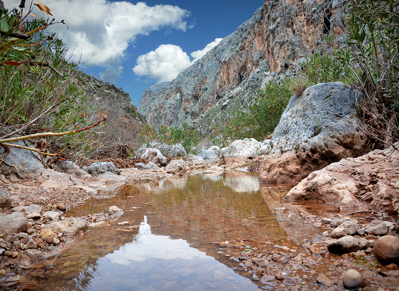
From the beach of Karoúmes, we walk along the stream for approximately 500 m, until the entrance to the gorge; this is smaller than the gorge of Zàkros, yet it does not lack natural beauty and interesting geological formations.
We walk through the gorge for about 1.500 m, until its western outlet, where we see an information sign, at the end of a dirt road. We next follow a dirt road, along the northern bank of the stream, and after approximately 600 m we pass onto the southern bank and reach a parking area, where a small chapel can be seen.
From the chapel and on we continue westwards, until the village of Hohlakiés; we arrive there after approximately 400 m, right where we come upon the main road that connects Zàkros with Palékastro.


(*Note: the information on gorges, caves and the hiking trails E4 of the Sitia region are general. The visitor is responsible in every case to evaluate his/her personal abilities and knowledge in order to choose the appropriate way to enjoy the proposed routes and sights)